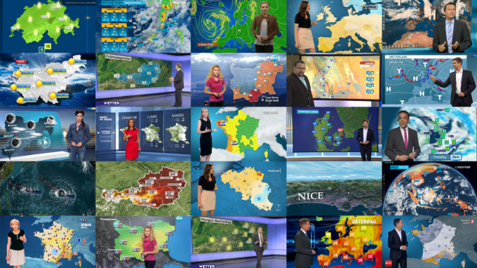
Chyron Weather is an end-to-end weather visualization suite that delivers professional weather coverage to your audience with visually rich map-based graphics, custom forecast elements, dynamic global analysis, and lifelike low-level flythroughs. Combining total freedom of data integration with exceptional ease of use in graphic design and live presentation - Chyron Weather makes it easier than ever before to deliver compelling day-to-day forecasts. With a flexible system architecture, Chyron Weather is the perfect fit for a single weekly program or 24/7 global coverage across a major broadcast network.
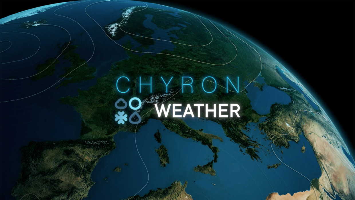
Chyron Weather™
Data-Driven Weather Visualization Suite

Connect
Utilize the combination of meteorological data you need to tell the story and tailor data values to match your ideal presentation
Visualize
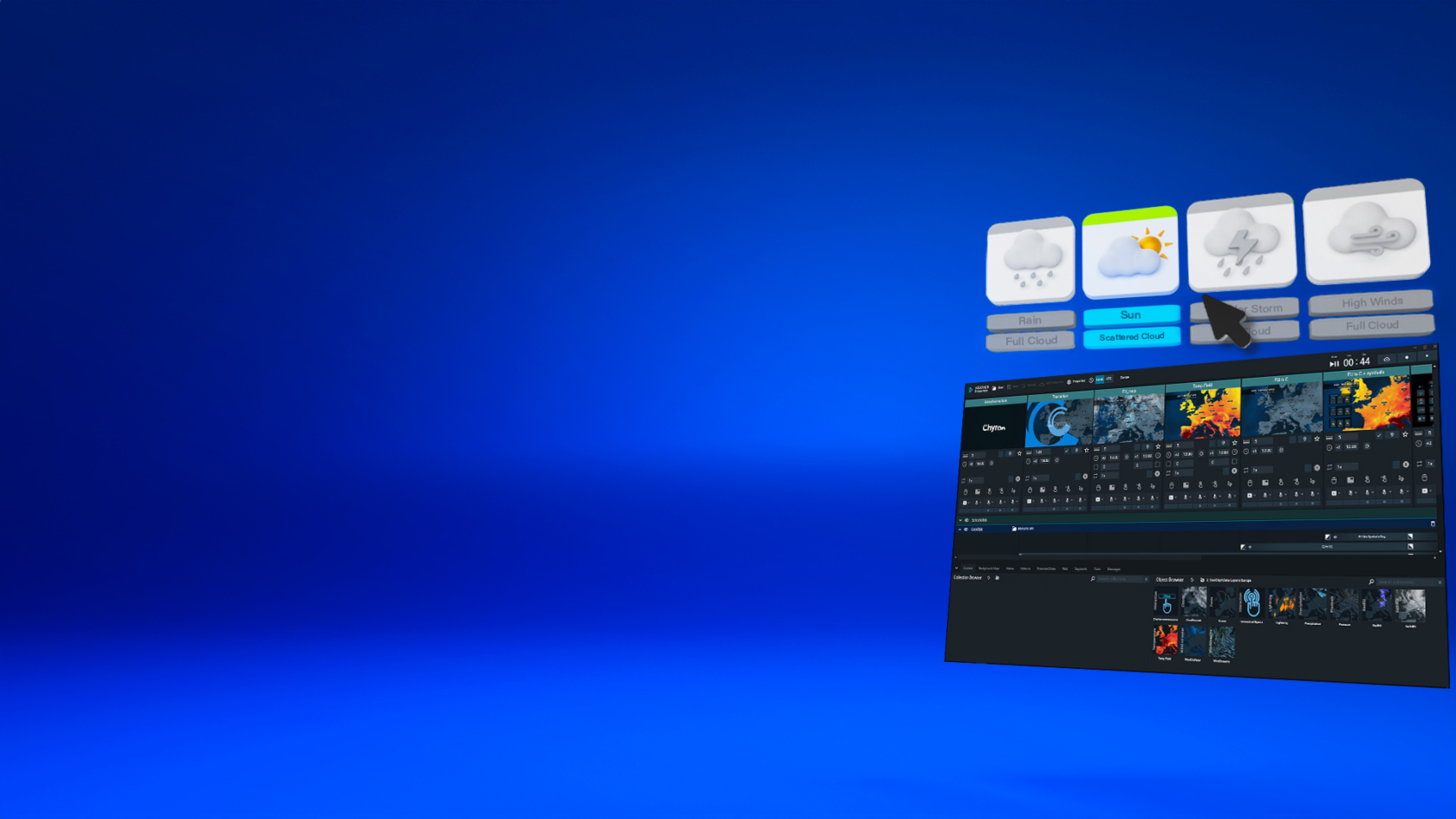
Leverage flexible authoring tools to design and stylize maps, graphics, and forecast assets to your unique brand.

Forecast
Go live with professional weather presentations that combine map-based graphics, global analysis, and lifelike 3D scenes
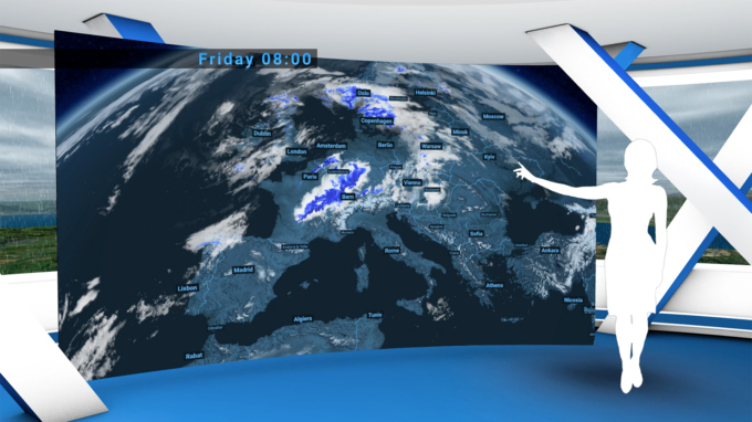
Fluid Real-Time Weather Forecasting
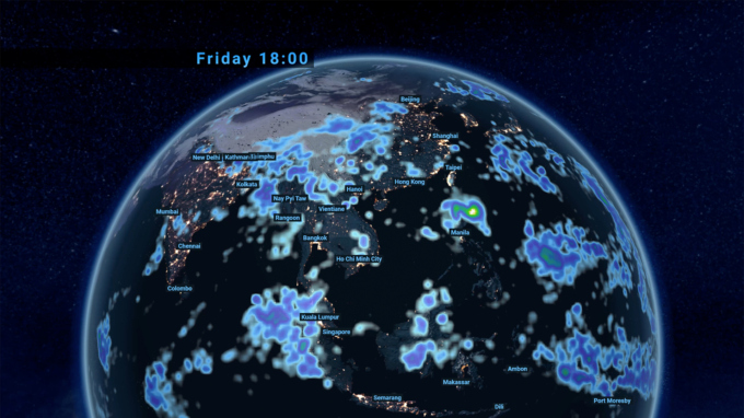
Bring forecasts to life with incredible flexibility in on-air weather storytelling with a simple scene-by-scene playlist interface that makes it easy to assemble and customize your show with different content, timing, and map positions. Seamlessly combine map-based graphics with fluid 3D global analysis, while further enriching the story with custom illustrations and highlights built in Chyron Weather’s timeline-based editor.
Simple Design, True-to-Data Visualization
Visualize meteorological data with an authoring tool that provides total freedom in graphic design and data integration. Stylize maps and meteorological elements as you see fit, massage data sets to suit your presentation needs, and bind data to virtually any graphic property you need to visualize the weather for your audience. For special weather events, Chyron Weather can bring forecasting to lifelike 3D scenes with true elevation models and high-resolution textures.
Data Provider Agnostic
Merge the combination of point data, file-based satellite/radar data, and GRIB file meteorological data you need to tell the right story for your audience. Chyron Weather simplifies data management and automation of background processes with visual drag-and-drop node workflow tools, along with extensive scripting capabilities to transform data APIs and non-standard data sources to your visual needs.
Scalable System Architecture
Serve a weekly program with a single-server base package or power concurrent, high-end forecasts with distributed applications across multiple engines. Chyron Weather is deployable via powerful on-prem hardware, cloud-based systems, and virtualized back-ends. Address live playout across numerous screens and studios, and handle high-volume rendering jobs for web and social media with a distributed workflow across a multitude of client servers.